

Collaborative Mapping
Client/Target Audience
At Village & Syracuse University | Central New York community with disability
Role
Design Research Graphic Design Applied Game Design UI UX Design
Industries
Design for Accessibility
Date
August 2022 - Present
What is unique about Collaborative Mapping? • It utilizes collaborative mapping design to improve access to awareness of accessible spaces for the disabled community of Syracuse: o Web and app design to allow for hyper-relevant maps that can be updated by the community to create a collective space to discover accessible spaces. o Immersive video game design to spread awareness about inaccessibility. o An accessible controller for wheel and power chair users. o Prototypes at the Human Performance Institute and the Syracuse University Warehouse with notable community members of Syracuse. o Submission for NEA Our Town grant.
Research Problem
Individuals are disabled in various ways by the environment, incudling city infrastructure. The city of Syracuse, located in Central New York, like any other city has individuals with disabilities that would benefit greatly from a step forward through accessible design. Given the systemic nature of the problem of inaccessibility in a city, it is clear through research and experience that navigating public spaces in central New York for an individual with a disability is challenging.
We realized through primary research and communication with AT village that Central New York possesses a multitude of accessible facilities and locations, so it was imperative to understand why the reviews suggested lack of accessible facilities.
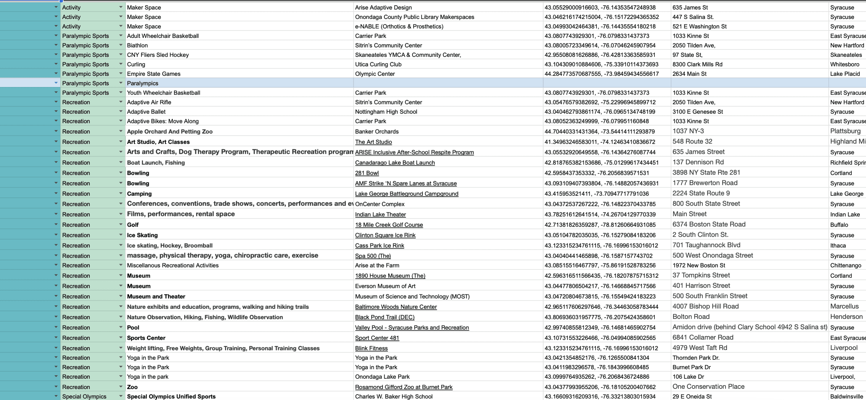
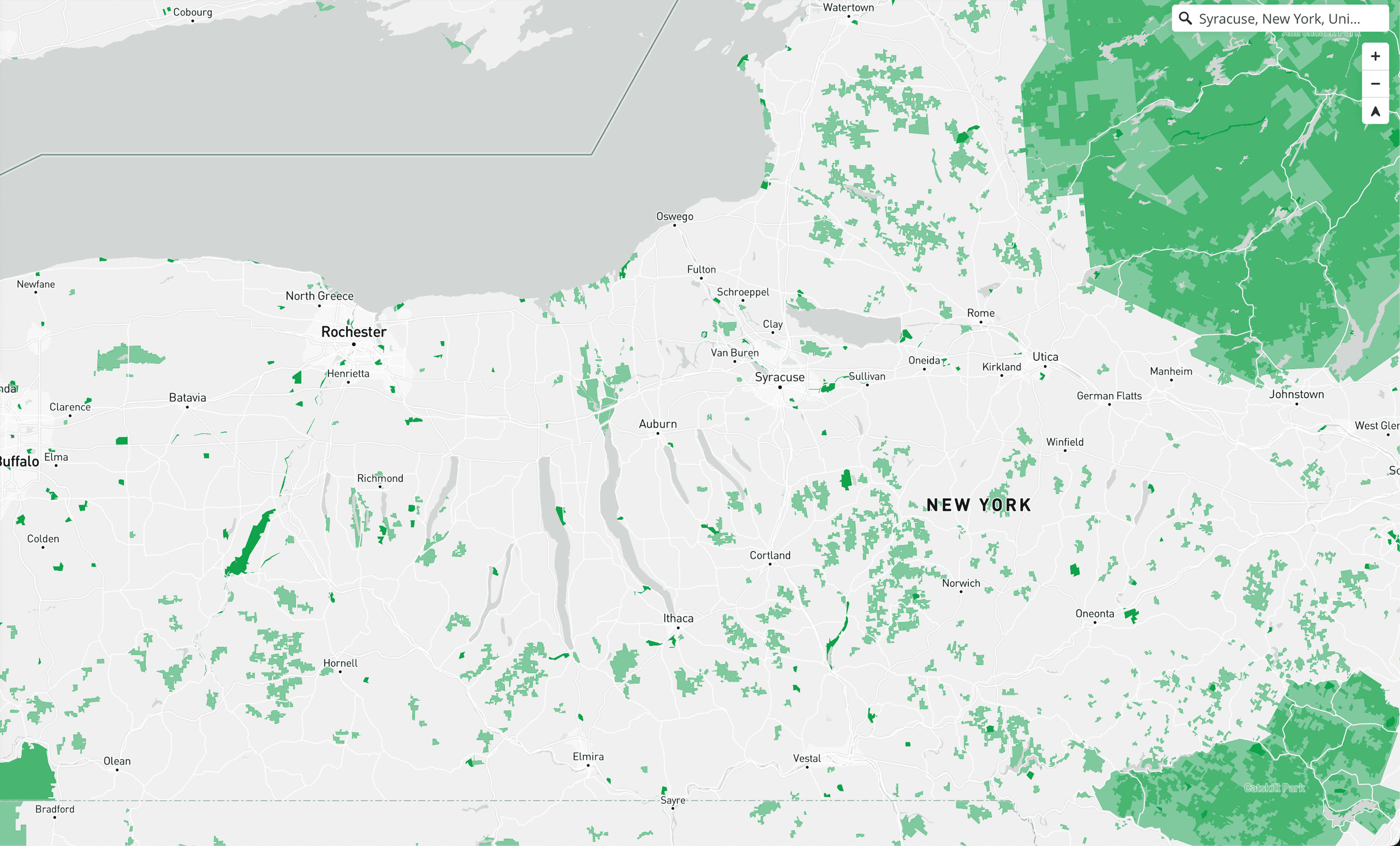
Over 200 accessible facilities were discovered in Central New York, and were categorized them into leisure, outdoor activities, sports, restaurants, maker-spaces. Since all of these places existed, it was important to understand the relationship that people with disabilities had with these facilities. Surveys were sent out to individuals with disabilities, asking them if they knew about and participated at prominent accessible spaces in Central New York. These surveys were handed sent out electronically, and filled out in-person at the Human Performance Insitute, Syracuse University Community Center, as well as by clients of the Doctors of AT Village. Through this, we our research problem evolved from 'the lack of accessible spaces' to 'the lack of understanding of the existence of accessible spaces and how to locate them'.
Solution
Communication to spread awareness about the existence of accessible facilities would boost knowledge about these areas. The solution was to create access to a web of knowledge about and locations of the accessible areas around individuals. Communication possesses immense potential to proliferate knowledge, boosting the lives of individuals with disabilities by connecting them to accessible facilities around them
Ideation and Prototyping
The ideation and prototyping process was done in reaction to a three stage process: 1) Initial literature and client (AT Village) based research oriented ideation and prototyping 2) Survey (30) and interview (client and user) based prototype modification of the prototypes 3) Feedback from the Human Performance Institute and the Syracuse Community Center Meet.
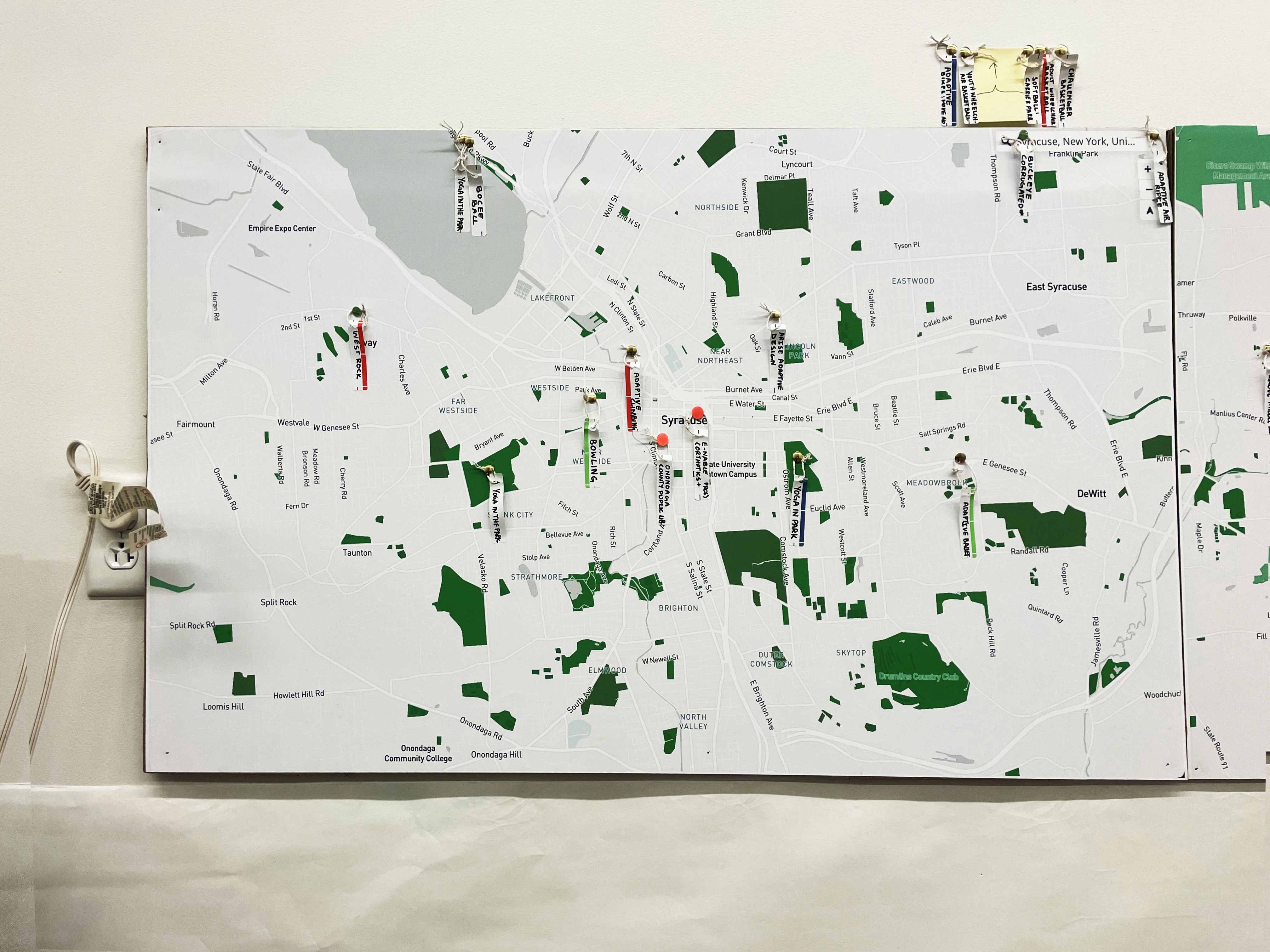
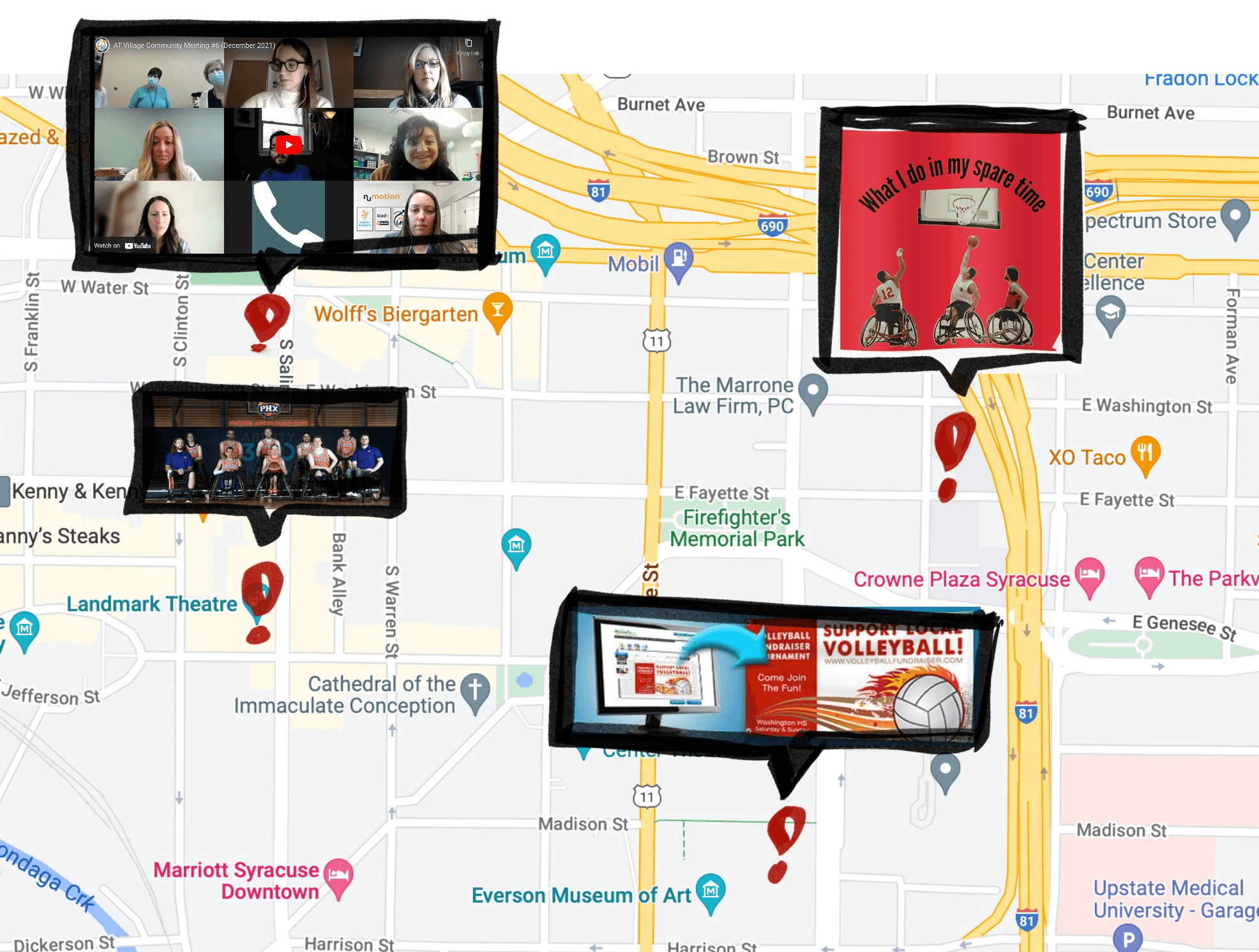
The team began to pin notable locations on a physical map in Central New York. These locations were then collated into a Qualtrics survey that was sent out to individuals with disabilities in Central New York. A large amount of the recipients of the survey were associated with organizations like Move Along, Arise Adaptive Design, and the Human Performance Institute. Here were some common responses across surveys: - A brochure or QR code linked to a list of activities and information about the activities, equipment availability, and hand bikes. - All of the examples above as well as a brochure or QR code linked to a list of programs and information about the activities. - Charging stations, paved platforms and pavilions for picnicking, accessible picnic tables, accessible hiking paths (hard firm gravel or paved paths), accessible bike paths/routes and an accessible bike rental program would be amazing, accessible boat launch for canoeing or kayaking, plenty of accessible parking, accessible charcoal grills, accessible playground. - If interactive, a filter for disability type and what programs are offered for that specific disability, (ex-blind versus deaf versus quadriplegia). Travel time and something that notes if it's along a bus route would be helpful. - The accessibility of the activity, how to get there, travel time. - Adaptive equipment loans/ rentals, where programs are housed and a link to a calendar of events, accessible pathways in communities and through green spaces (links to Inclusive Recreation Resource Center's database). - Awareness about accessibility.
To address the complex challenge, the team proposed a multifacted package, consisting of: 1) A website prototype where people could plug in relevant information about accessible locations (Software: Airtable) 2) An app to reflect the website (Software: Airtable) 3) An applied game to spread awareness about accessibility through an immersive experience (Software: Unity) 4) A physical map with QR codes to access the website that could be placed at centers for disability to spread awareness about our project 5) Rebranding of the the client AT Village. These five facets are what make the 5 houses of the new AT village logo as shown above.
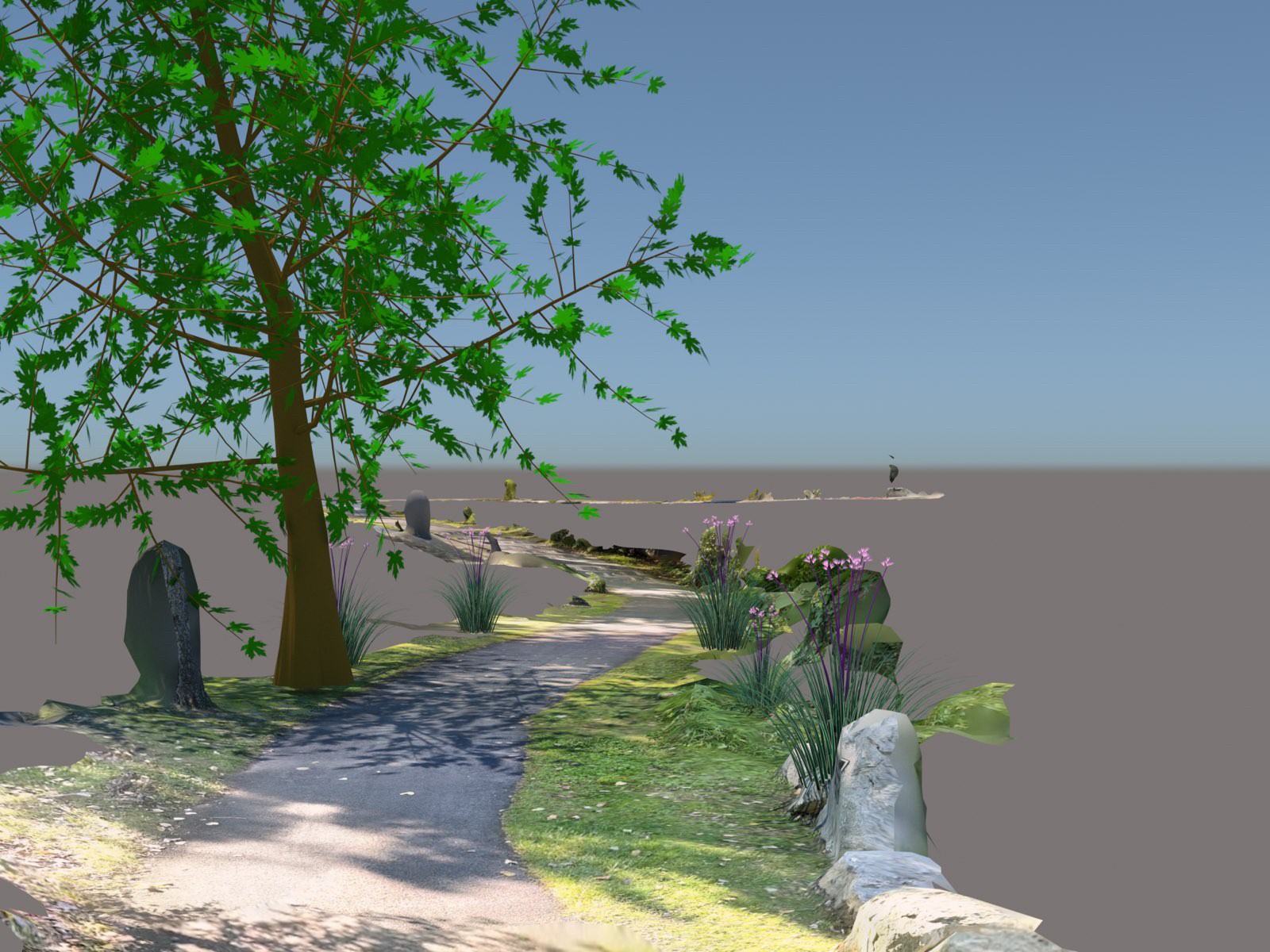
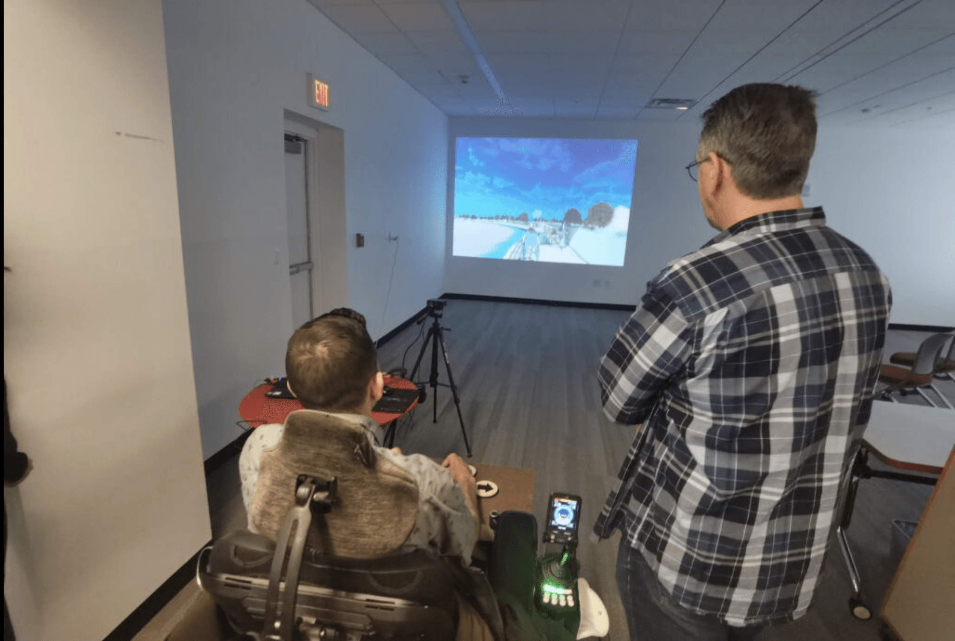
While the literature and survey data were gathered by 2 of us from the team, a decision was made to split the team into the mapping group and game group. My primary role from this point onwards was to produce a game to spread awareness about accessibility in Central New York through an immersive game design. I was to also further collate gathered data from surveys and research and ensure their correct insertion into the mapping team designs, while also designing the visual icons for the them. The game design process started with a walk through an accessible area in Syracuse known as the creekwalk while conducting LIDAR mapping. 8 3D renders were obtained, which were stitched together to form the Creekwalk model in the game.

A wheelchair player character was introduced to the Creekwalk game, along with obstacles like e-scooters (which are a prevalent obstacle for wheelchair users in Syracuse). Restrooms and pedestrians were added, which served as obstacles to circumvent. The gamified disability experience was designed to inform people about the various obstacles that wheelchair users encounter while navigating in everyday life in Syracuse and beyond. As every gamified experience requires a base navigable map, Onondaga Creekwalk, an archetype of accessibility, was created digitally to fit the same through LIDAR mapping (using iPhone Camera), 3d modeling (3Ds Max), Blender (Animation) and game design (Unity). The gamified disability experience uses real life observation, experience as well as data from surveys to create a digital pathway with obstacles that the character player (wheelchair user) can traverse. The obstacles involve pedestrians blocking the path, irresponsibly placed e-scooters, bathrooms that require stairs to access, the actual staircases that exist on the Onondaga Creekwalk, etc. The ultimate objective of the gamified experience is to have the user traverse from one end of the Creekwalk to the other while overcoming the aforementioned obstacles. The gamified experience exists in its beta test version and has room for further development in terms of fidelity with regard to dialogue and sound effects. As mentioned below, a specialized controller was created keeping wheelchair users in mind to work in congruence with the gamified experience.
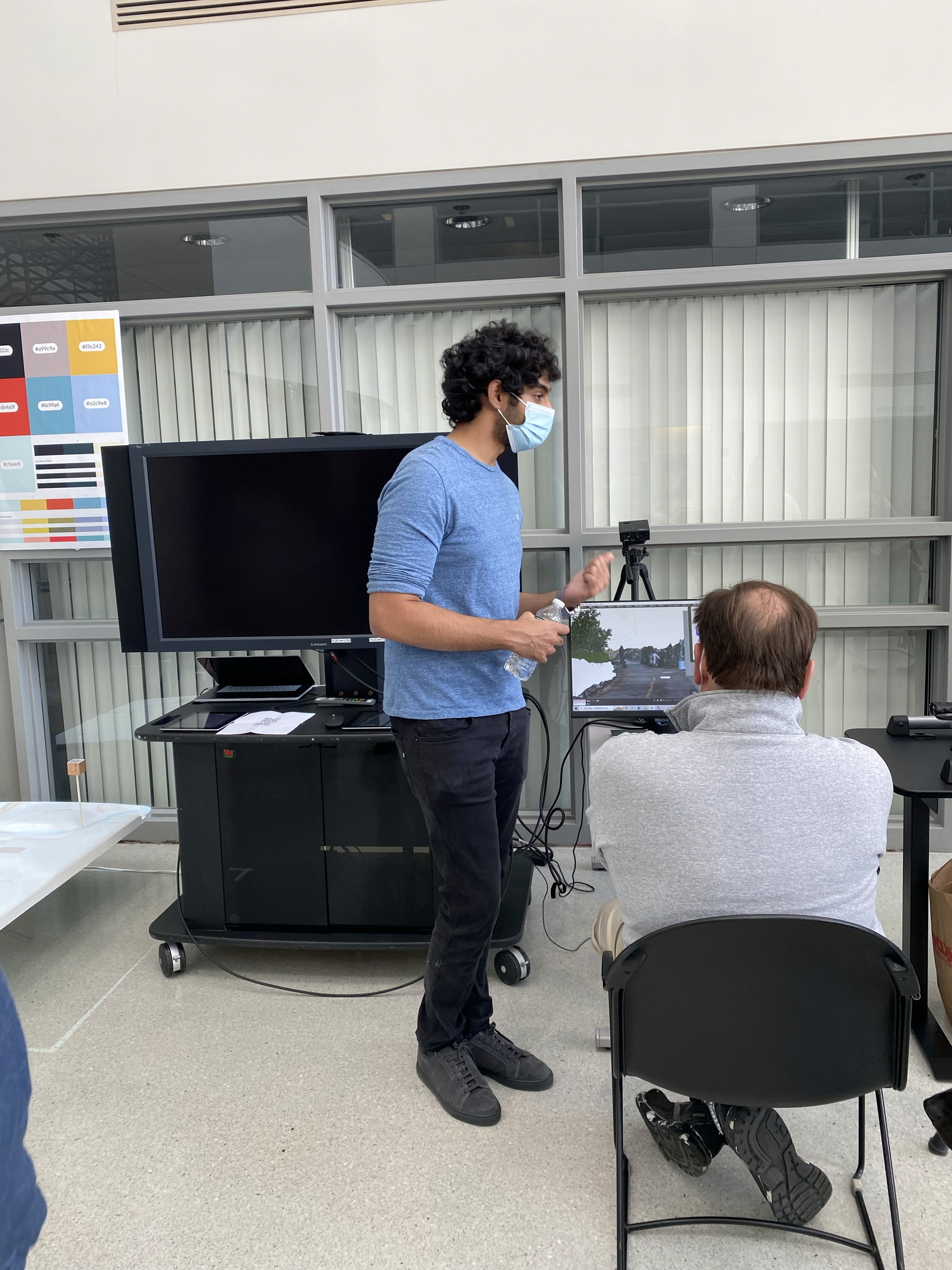
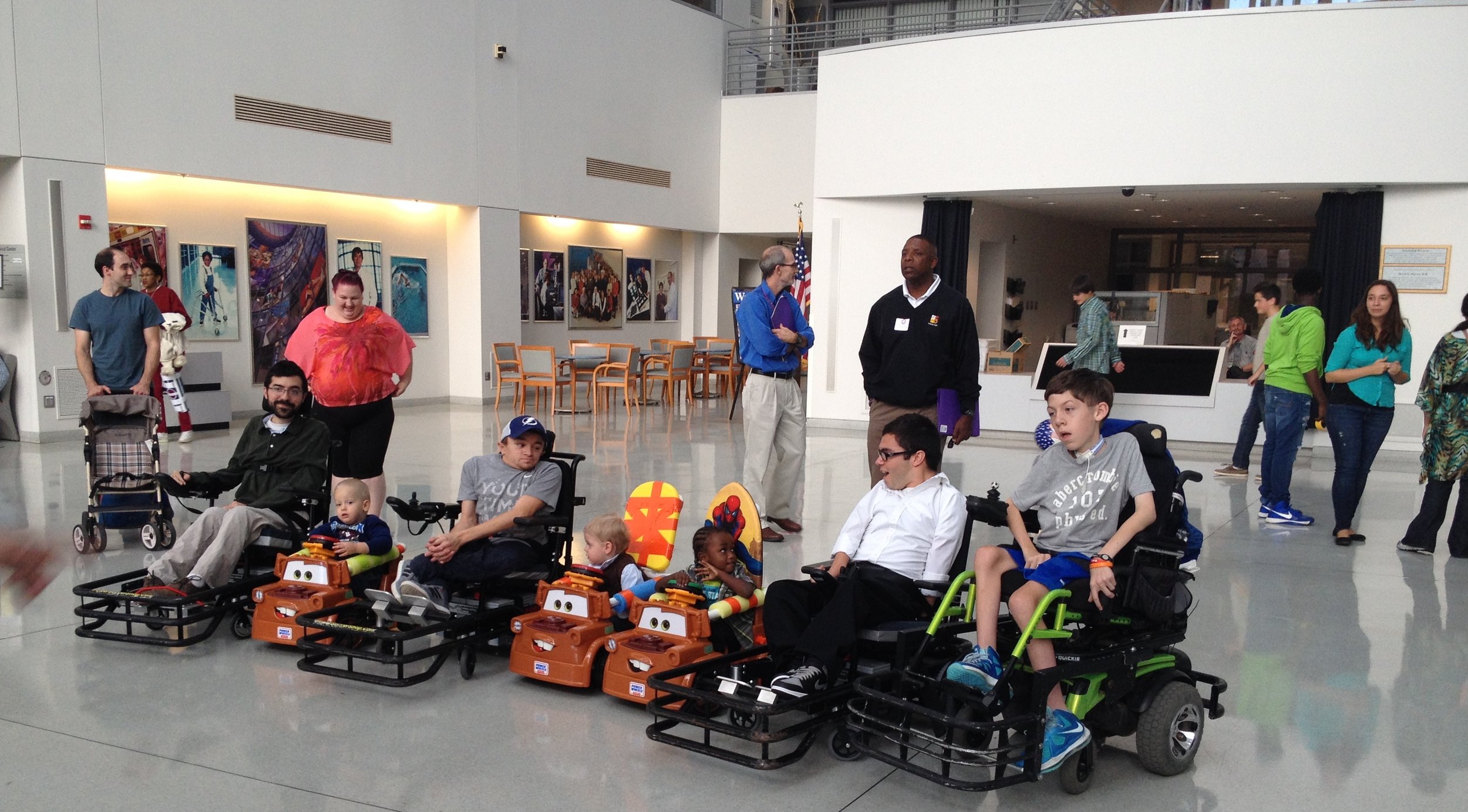
This prototype was then taken to the Human Performance Institute, where it was presented to multiple visitors at an event space. The participants included the college students, medical students, doctors, the elderly, random visitors, and more. This gave us a lot of data as to how to proceed with game development in terms of mechanics and obstacles. The response to the applied game was overwhelmingly positive, with users better understanding the difficulty of users with disability having to navigate inaccessible spaces in cities.
Final Outcome
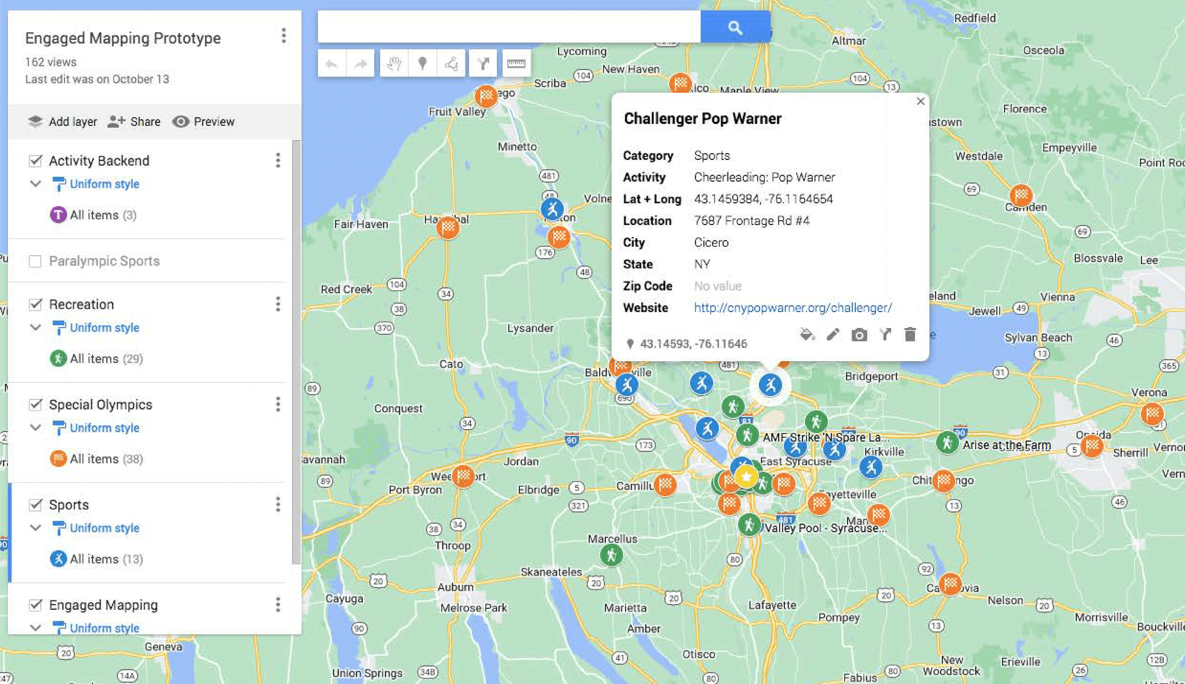
The hyper-relevant mapping website design is a concept that displays accessible locations around Central New York. The concept is open-source for users to log in and update the map as a community. Gathering data for the map through research, surveys and interviews was essential for its development. When published, this website will be updated by users and monitored by moderators from AT Village
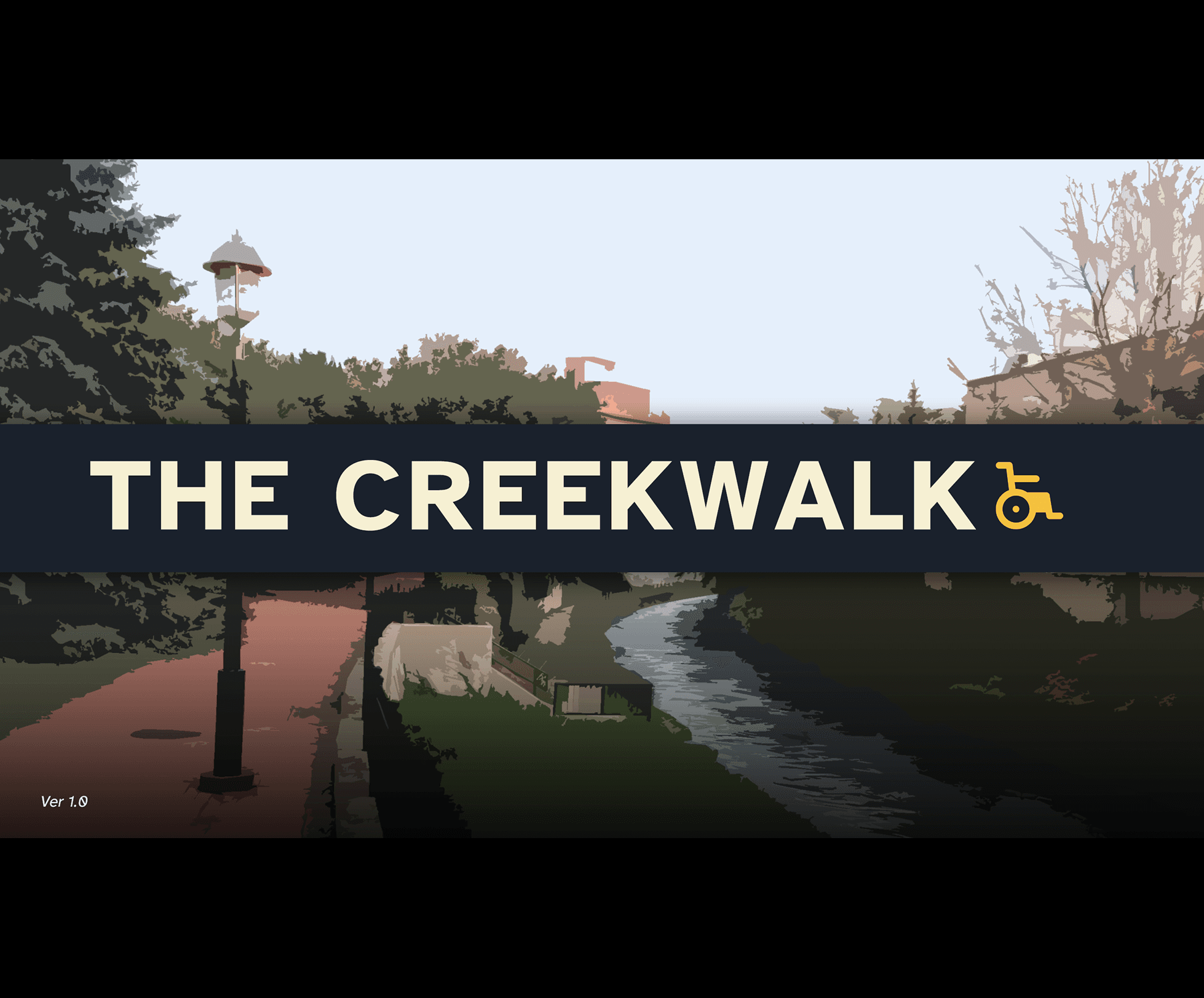
The Creekwalk Game start screen represents the finalized design style of the game and other deliverables. Click on the image to be redirected to an actual working prototype of the game.
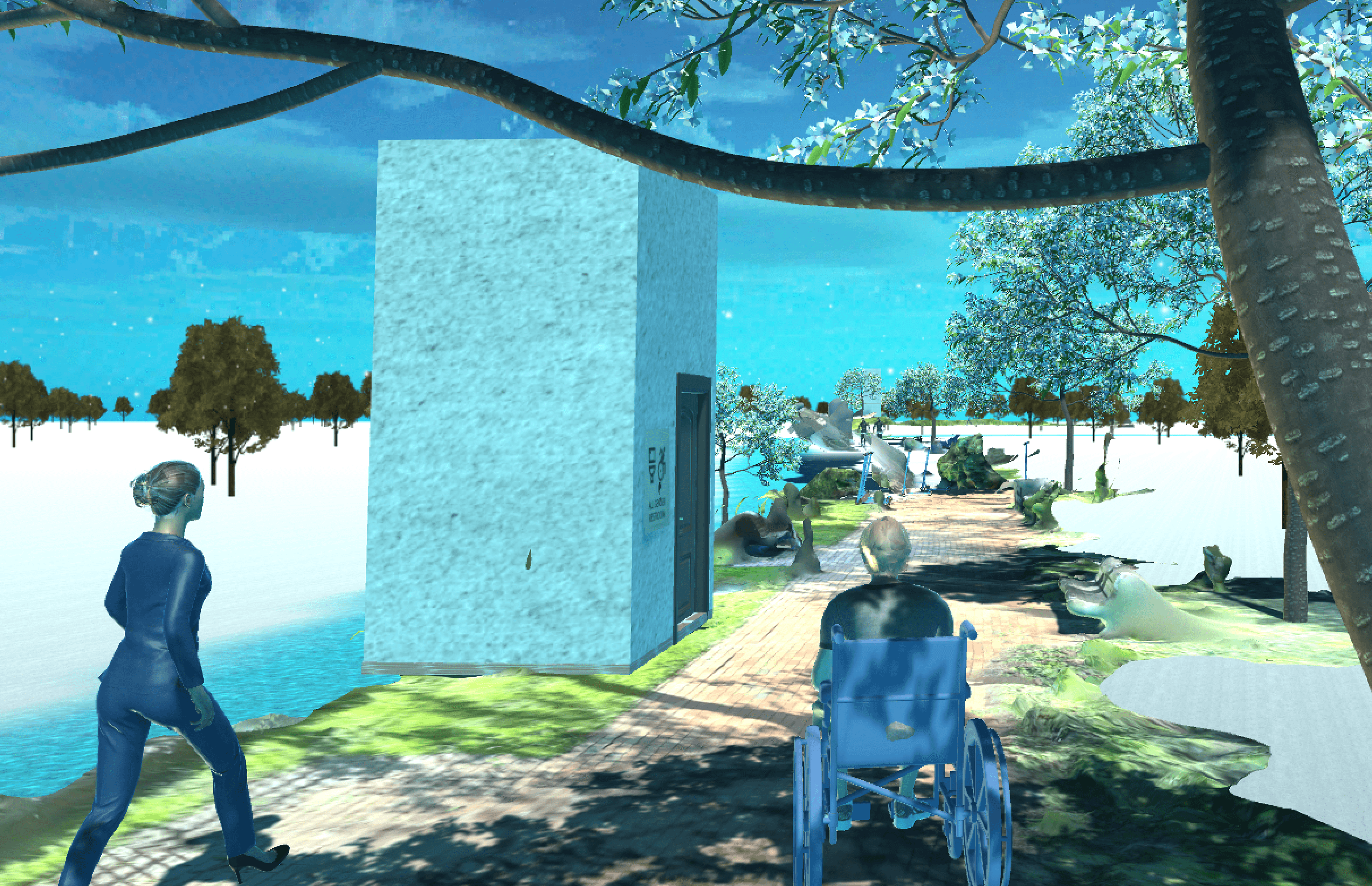
Creekwalk, the immersive applied game reached version 1.0. Users can enjoy the early stage immersive experience as a wheelchair user to better understand the need to improve accessible cities. This version of the game uses real world elements like artwork present at the actual Creekwalk, as well as higher fidelity obstacles with improved physics.
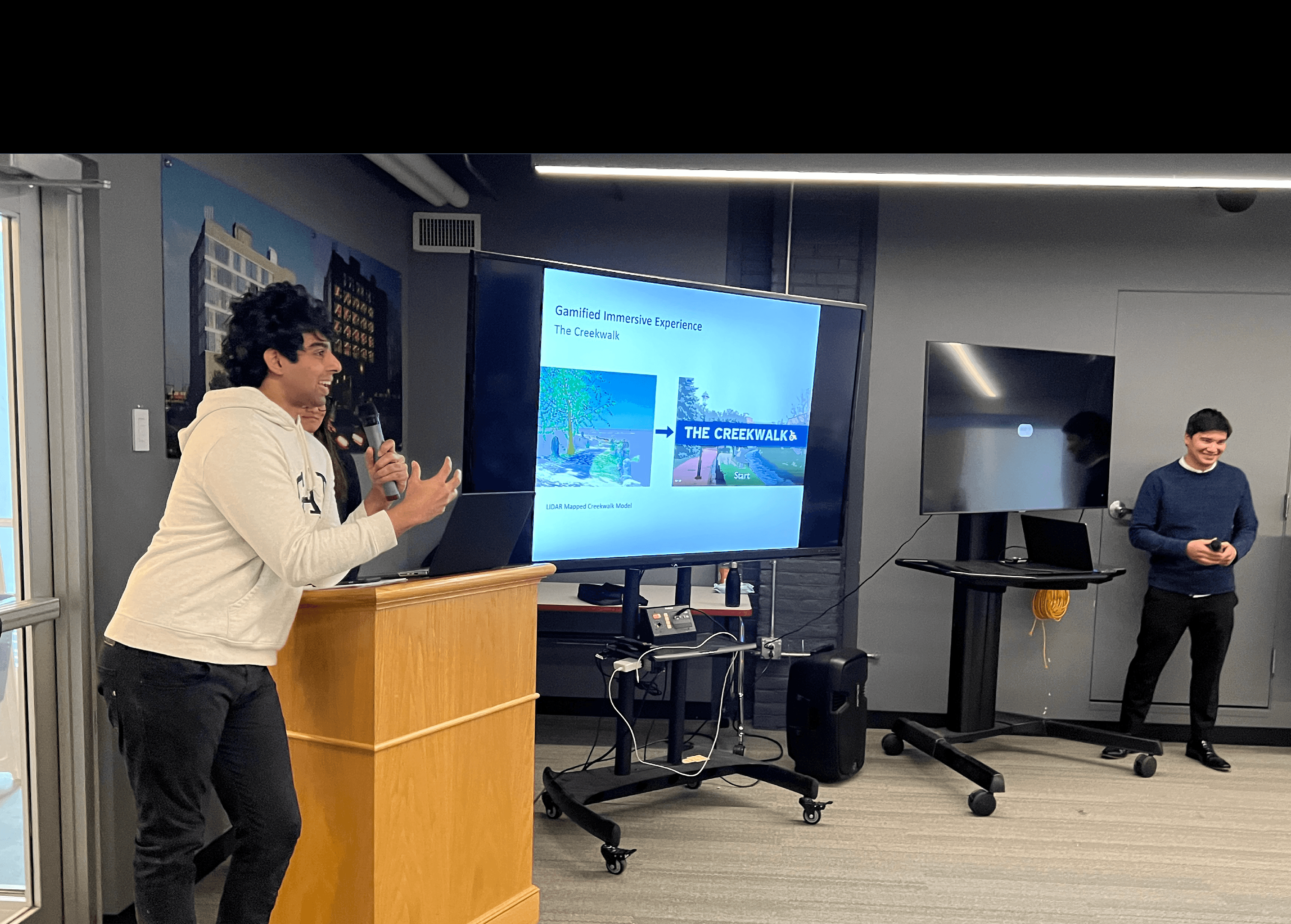
A presentation of the Collaborative Mapping project at the Nancy Cantor Warehouse to notable personalities in Central New York. AT Village, HPI, Arise Adaptive Design, an olympic power soccer athlete, accessible city designers, etc., were present at the event. The project received a positive response and potential collaborators for future steps
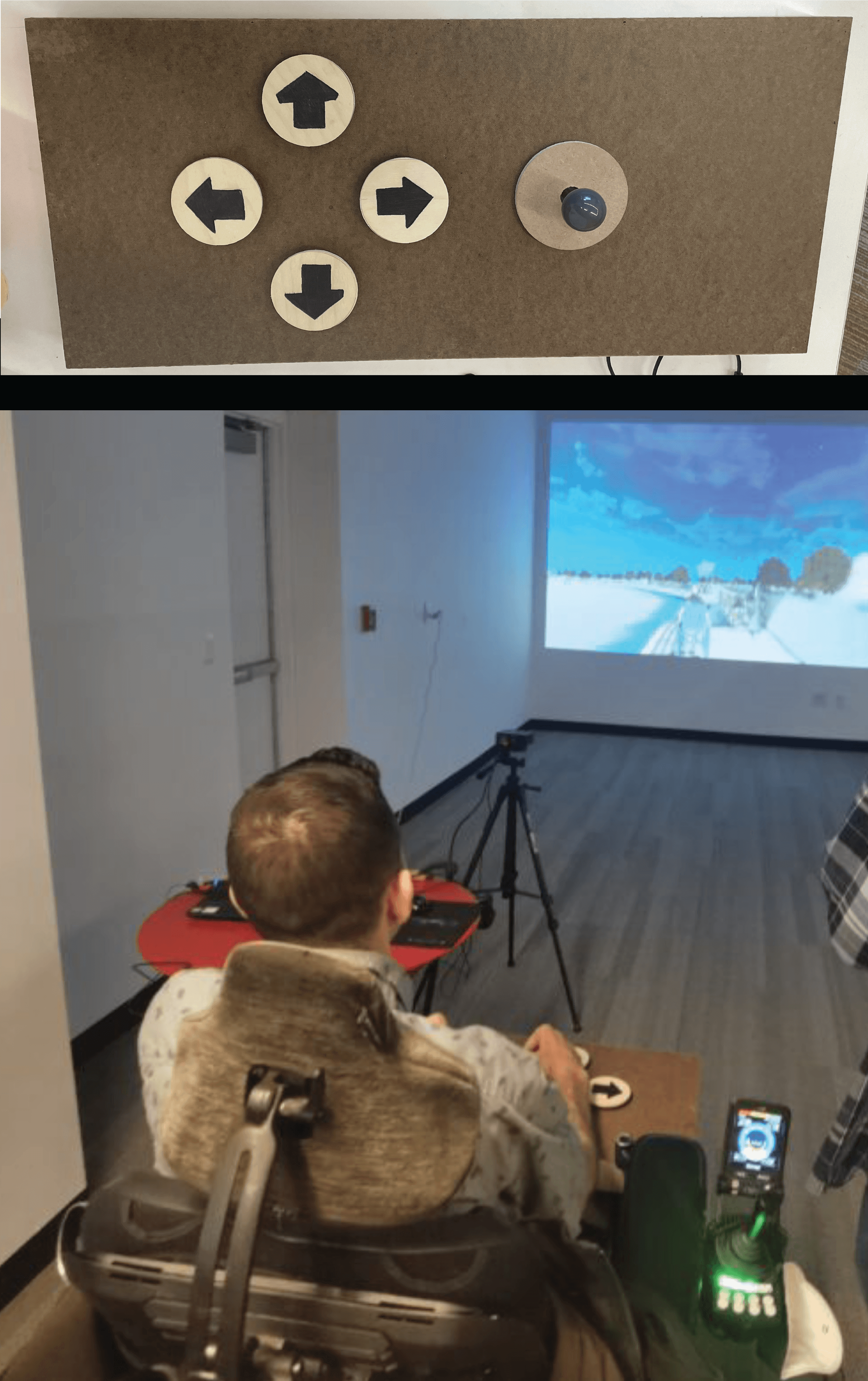
It was apparent early in research that a controller interface for the game would greatly improve the user experience and expand the population of potential users. Within the user testing context, no on-the-market controllers were both compatible with the development software and adaptive. To solve this problem, a PXN 0082 Arcade Fight Stick Joystick was purchased from a large department store in Syracuse, NY. This was first utilized at the Fit-In conference, where a number of users were able to test the game and explore the Lidar mapped creekwalk as an early prototype. While this was an improved interface, the controller was still not adaptive and had too many buttons for the use case. The PXN 0082 was then re-configured as a low fidelity adaptive controller, with a larger housing and only 4 large (3” diameter) buttons for intuitive use. This process improved the UX significantly and improved the game’s accessibility as it allowed for a seated ability collaborator to play the game.
Overall Reflections
The end result is a multidiscplinary solution that utilizes web design and app design to use the hyper-relevant interactive map for users who can update the map to reflect relevant changes in Central New York. The educational applied game design is intended spread awareness about navigating cities that have not been designed for disability in a push to garner allies for the cause. The physical map design utilizes QR code based AR mapping and is to spread awareness about the system. The project currently is still in developmental stages. While the research phase is complete, the designs would beenfit from more user testing.
Future Steps
While the project has a come a fair way, it is a sizeable undertaking that will require further development and refinements. This will require funding, for which the project has been submitted for the NEA Our Town Grant. With sufficient funding the hyper-relevant maps will go live and will be managed by a moderator at AT Village, whereas the game will be developed further with more depth to levels, types of immersion through disability, and more levels to create an applied game that is not only educational and inspiring to act, but also entertaining. The initial release is to be focused on Central New York, with further expansion to follow.